What’s Happening?
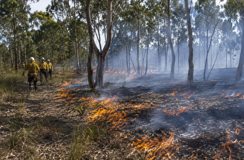
Queensland Parks and Wildlife Service and Quandamooka Yoolooburrabee Aboriginal Corporation will conduct a planned burn on North Stradbroke Island (Minjerribah).
The burn will take place at 18 Mile Swamp, within Naree Budjong Djara National Park and Minjerribah Recreation Area.
The operation is part of the fire management program for the park and recreation area.
The Main Beach camping area will be closed to public access during the planned burn.
Visitors to Naree Budjong Djara National Park and Minjerribah Recreation Area are being told to follow all signs, barriers, and ranger directions.
People must not enter closed areas.
Why It Matters?
Planned burns help support ecological health, biodiversity, and the conservation of species and habitats.
They also help reduce the risk and intensity of bushfires.
This work is aimed at lowering potential impacts on communities, infrastructure, parks, and forests.
Public safety remains the highest consideration in all QPWS fire management activities.
By the Numbers
- The planned burn applies from 3 June to 7 June 2026, weather permitting.
- One public access area, the Main Beach camping area, will be closed during the operation.
Local Impact
Smoke may be seen across Minjerribah, also known as North Stradbroke Island.
Areas likely to notice smoke include south of Alfred Martin Way, Main Beach, and nearby areas such as the Southern Bay Islands.
People with respiratory or other health issues should seek medical advice about reducing the effects of smoke inhalation.
If smoke affects your area, stay indoors and keep windows and doors closed.
Zoom In
The alert applies to Minjerribah Recreation Area and Naree Budjong Djara National Park.
The closure is listed as a fire closure or access restriction.
Visitors should check conditions before travelling, especially if planning to access Main Beach or nearby areas.
Updated local QPWS fire activity can be checked through Park Alerts: https://parks.desi.qld.gov.au/park-alerts.
More information about fire management is available here: https://parks.qld.gov.au/management/programs/fire-management.
Air quality data, smoke information, and dust updates are available here: https://www.qld.gov.au/environment/management/monitoring/air.
Zoom Out
Planned burns are carried out across the year when conditions are suitable.
They form part of wider fire management work across Queensland parks and forests.
On Minjerribah, the work also supports long-term protection of cultural and environmental values across the island.
What To Look For Next?
The burn will continue only if weather conditions remain suitable between 3 and 7 June.
Further updates are expected through official Park Alerts if access restrictions, smoke impacts, or closure details change.