What’s happening?
Redlands Coast has expanded its flood warning network with new and upgraded equipment across mainland and island locations.
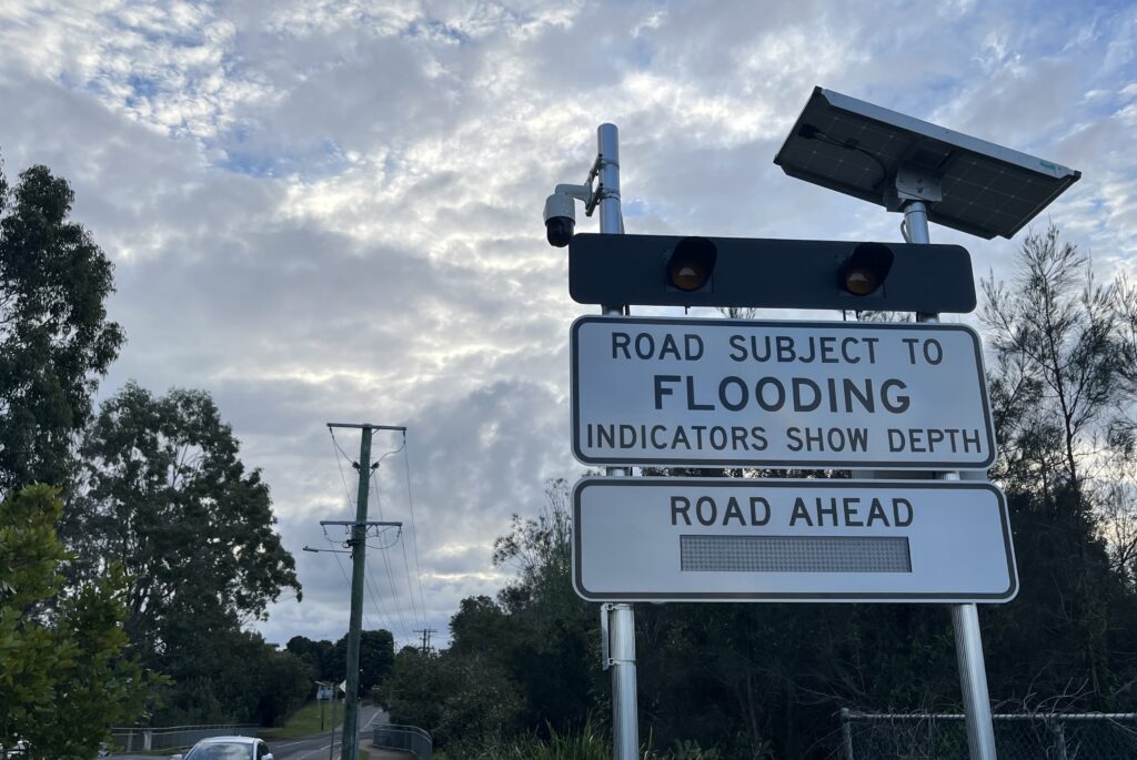
The work includes LED road closure signs, flood cameras, electronic rain gauges and a water level sensor. Together, these assets will provide clearer information during severe weather and help improve road safety.
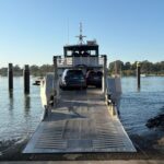
New equipment was installed at Avalon Road in Sheldon and Moores Road in Redland Bay. Other locations include the Giles Road closed landfill site, Macleay Island Council Depot and Point Lookout.
Further upgrades were completed at Sovereign Waters Lake and the Pitt and Nelson roads intersection in Wellington Point.
Why it matters?
The equipment gives first responders remote access to changing conditions across the city. This helps emergency crews assess flood risks and respond sooner when roads become unsafe.
Acting Mayor and Local Disaster Management Group Acting Chair Julie Talty said the network would strengthen local flood monitoring.
“These assets provide important information and real-time data to assist with situational awareness during severe weather events,” she said.
The LED signs can activate automatically when flooding closes a road, warning drivers before they enter a dangerous area.
“Road closure signage activates automatically, ensuring motorists and other road users are alerted to flood hazards and can avoid the area,” Cr Talty said.
“Cameras installed at these locations also allow for the monitoring of conditions and will assist with timely emergency responses to flood-related incidents.
“This high-tech equipment provides remote access to vision of rising flood water levels, giving both emergency service providers and drivers up-to-date information to enhance safety.”
Local Impact
The expanded network gives disaster management crews a clearer view of conditions across more parts of Redlands Coast.
This is particularly important for the islands, where rainfall can differ greatly from conditions recorded on the mainland.
New electronic rain gauges were installed at the Giles Road closed landfill site in Redland Bay and Macleay Island Council Depot. Another gauge was added at the North Stradbroke Island Wastewater Treatment Plant in Point Lookout.
“The new assets will ensure disaster management crews have better awareness of conditions across more areas of the city,” Cr Talty said.
“We know the island gauges will make a big difference, as the rainfall totals in these areas can differ significantly to the mainland.”
The wider coverage will help crews compare rainfall across Redland Bay, Macleay Island and North Stradbroke Island during storms.
By the numbers
- The Australian Government contributed $234,000 towards five assets through the Flood Recovery and Resilience Package.
- Redland City Council funded two further assets at Sovereign Waters Lake and Wellington Point.
- Three new electronic rain gauges now cover Redland Bay, Macleay Island and Point Lookout.
“Through the Flood Recovery and Resilience Package funded under the former Emergency Response Fund, the Australian Government provided $234,000 towards five of the new assets, with Council funding a further two,” Cr Talty said.
Zoom In
Avalon Road, Moores Road and the Pitt and Nelson roads intersection received upgraded flood cameras and LED road closure signs.
The equipment has already supported local road safety during heavy rainfall in May. All three sites activated their warning signs when flooding affected nearby roads.
“We saw the benefits of this infrastructure during the heavy rainfall event in May, with all three sites illuminating to warn motorists of road closures,” Cr Talty said.
Camera images also gave residents a direct view of rising water through the Redlands Coast Disaster Dashboard.
“Still images of the rising floodwaters were also available for the community to view on the Redlands Coast Disaster Dashboard,” she said.
A new water level sensor at Sovereign Waters Lake will provide further information as conditions change during future rainfall events.
Zoom Out
The Australian Government funded five assets under the former Emergency Response Fund, while Council funded the remaining two.
Federal Minister for Emergency Management Kristy McBain said the investment would help Redland City prepare for future flooding.
“The Australian Government is committed to delivering resilience and risk reduction initiatives right across Queensland,” Minister McBain said.
“We know that upgraded early warning systems that provide better information are a major boost in flood preparedness across the community and saves lives.
“We’ll continue to invest in initiatives like this because we know how important preparedness is to the resilience of local communities.”
The project forms part of broader work to improve flood information and emergency response systems across Queensland communities.
What To Look For Next?
The expanded network should provide faster local information during future storms, helping crews respond as conditions change.
Residents will also have access to flood camera images and warning information through the Redlands Coast Disaster Dashboard.
The dashboard is available HERE.