
What’s Happening?
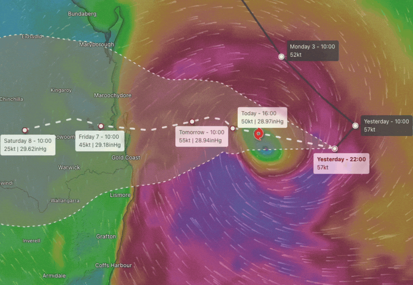
Tropical Cyclone Alfred has made a sudden U-turn in the Coral Sea and is now tracking towards south-east Queensland.
After moving south-eastwards for several days, the cyclone took a sharp westerly turn yesterday and is expected to make landfall near Brisbane in the early hours of Friday morning as a Category 2 cyclone.
Why It Matters?
The cyclone’s unexpected change of direction has prompted urgent preparations along the southern Queensland and northern New South Wales coasts. Strong winds, damaging surf, and abnormally high tides are already impacting coastal areas, while inland regions are expected to experience destructive winds and heavy rainfall today and on Thursday.
Additionally, storm surge is a major concern for low-lying coastal areas, with potential inundation in some locations. Residents should assess their risks using available mapping tools.
Local Impact
Coastal communities are bracing for severe weather conditions, including potential flooding, storm surges, and property damage. Emergency services are on high alert, and residents are urged to take necessary precautions, including securing outdoor items and monitoring flood-prone areas.
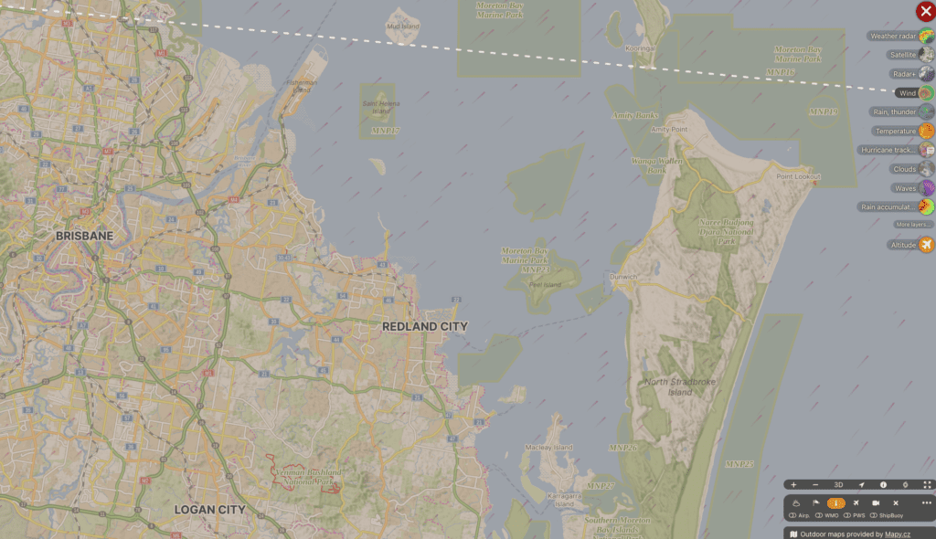
⚠️Windy’s live: Cyclone Alfred Tracker
⚠️ Storm Surge Risk
- Low-lying coastal areas could be impacted by storm surge as the cyclone makes landfall.
- Check properties of interest on Council’s mapping tools:
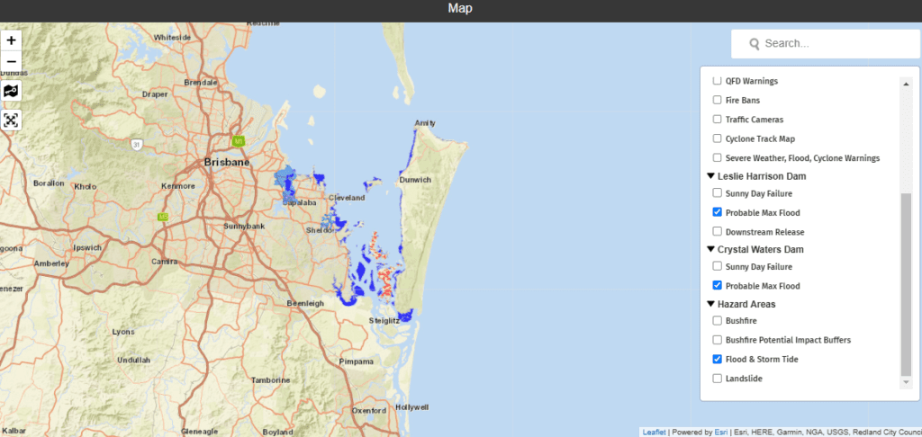
- Redland City Disaster Dashboard Map: https://disaster.redland.qld.gov.au
- Turn off “Severe Weather, Flood and Cyclone Warnings” and turn on “Hazard Areas” > “Flood and Storm Tide” to view possible storm surge inundation.
- Redland City Disaster Dashboard Map: https://disaster.redland.qld.gov.au
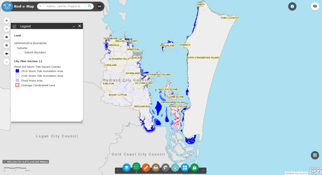
⚠️ Red-e-Map – City Plan Flood and Storm Tide Overlay: https://arcg.is/amib9
🚗 Car Parks at Risk
- Some car parking areas at Toondah Harbour, Weinam Creek, and Victoria Point are included in flood surge mapping and could experience storm surge inundation. Residents should avoid parking in these areas and move vehicles to safer locations.
By the Numbers:
- Category 2 Cyclone: Expected to make landfall near Brisbane with winds between 125-164 km/h.
- Timeframe: Early hours of Friday morning for landfall, with severe weather starting today and intensifying on Thursday.
- Impacted Areas: Southern Queensland and northern New South Wales coasts, with inland regions also at risk.
Zoom In
Residents along the coast and further inland should secure loose items, prepare for possible power outages, and avoid unnecessary travel. Those in low-lying areas should be aware of potential storm surge risks and check council flood maps for details. The Bureau of Meteorology (BOM) is closely monitoring the situation and providing regular updates.
Zoom Out
This sudden shift in the cyclone’s trajectory highlights the unpredictability of severe weather events and the importance of staying informed and prepared. Coastal communities, emergency services, and local councils are working together to manage potential impacts.
What To Look For Next?
- Stay updated on the latest forecasts and warnings via the Bureau of Meteorology website: www.bom.gov.au or the BOM Weather app.
- Check flood surge maps to assess the risk to your property or vehicle.
- Follow all advice from emergency services and local councils to ensure safety during this severe weather event.